We remain fully operational. Our teams are working around the clock to ensure your deliveries continue safely.

下载应用程序


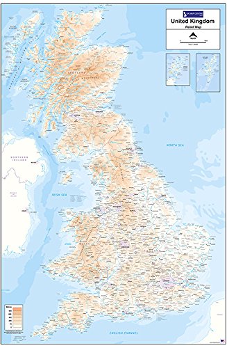
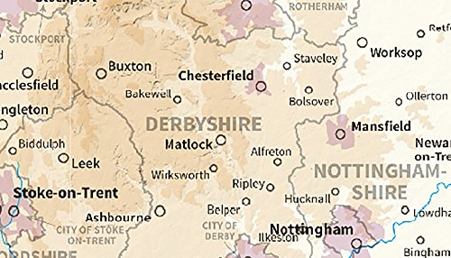
Material Type:Flat - Standard Matte Paper The Relief Map 1 utilises 1:800,000 scale Ordnance Survey mapping data to provide a clear and easy to use map of the UK with insets for Orkney and Shetland. An easy to use height key shows land height above sea-level across the country. Also noted are national boundaries for England, Scotland and Wales, as well as county boundaries for these areas. The map measures 900mm (width) by 1300mm (height).
TrustPilot
4天前
3 周前
5天前
1天前