描述
🛰️ Survey Smarter, Not Harder — Land Precision in Your Palm!
- SATELLITE POWER DUO - Harness the combined strength of GPS and GLONASS satellites for rapid, reliable positioning worldwide.
- CLARITY IN EVERY DETAIL - 2.4-inch backlit LCD ensures your measurements are visible anytime, even in low light conditions.
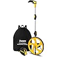
- ALL IN ONE SURVEYING SOLUTION - Measure straight & curved distances plus multiple area types—perfect for forests, farmland, and mountains.
- PRECISION THAT COMMANDS CONFIDENCE - Achieve ultra-low area error of 0.003 acres and distance error within 6ft for flawless land surveys.
- BUILT FOR THE FIELD DESIGNED FOR YOU - Lightweight (180g) ergonomic design with anti-slip grooves for comfortable, secure handling on rugged terrain.
The NiesahYan ZL180 is a compact, handheld GPS surveying tool featuring dual GPS+GLONASS satellite support for exceptional accuracy. Its 2.4-inch backlit LCD displays real-time measurements with minimal error margins (0.003 acres area, 6ft distance). Designed for outdoor professionals, it offers 4 versatile measurement modes, ergonomic handling at just 180g, and a robust 20-hour battery life—ideal for precise topographical mapping in forests, farmland, and mountainous regions.