We remain fully operational. Our teams are working around the clock to ensure your deliveries continue safely.

下载应用程序


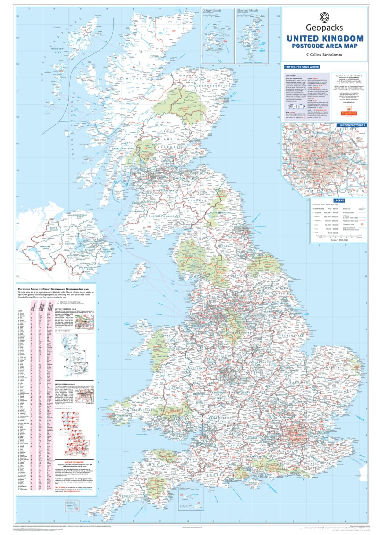


🗺️ Own the UK map that means business and adventure!
This large, laminated UK postcode wall map (830 x 1200mm) offers detailed county, district, and postcode boundaries alongside the latest 2026 road networks. Waterproof and tear-resistant, it’s designed for durability and easy cleaning, making it ideal for home or office use. Perfect for professionals, travelers, and planners who demand precision and style in one striking wall display.


| ASIN | B079T846LH |
| Best Sellers Rank | 120 in Educational Charts & Posters |
| Brand Name | Map Marketing |
| Colour | Multicolour |
| Customer Reviews | 4.8 4.8 out of 5 stars (34) |
| Item Dimensions L x W | 120L x 83W centimetres |
| Item Weight | 250 Grams |
| Manufacturer | Map Marketing |
| Map Type | Road & Planning |
| Paper Finish Type | Glossy |
| Paper Size | 120cm x 83cm |
R**L
Size & Post Code details
Great Map. Quite large but had all the details I needed. As a project manager with a property portfolio the post code detail is brilliant.
G**S
Pleased with it
Takes an age for the rolled up status to relax enough to be pinned up good quality.
TrustPilot
2 周前
2天前